Lhinvia: Difference between revisions
No edit summary |
No edit summary |
||
| (One intermediate revision by the same user not shown) | |||
| Line 7: | Line 7: | ||
|- | |- | ||
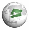
| colspan="2" align="center" |<div>[[File:Lhinvia_on_sphere.jpeg|100px]]</div> | | colspan="2" align="center" |<div>[[File:Lhinvia_on_sphere.jpeg|100px]]</div> | ||
|- | |- | ||
! colspan="2" style="background:#f2f2f2;" | General Information | ! colspan="2" style="background:#f2f2f2;" | General Information | ||
| Line 41: | Line 39: | ||
|- | |- | ||
| '''Vice President''' || [[Hôlami Inkjarharii]] | | '''Vice President''' || [[Hôlami Inkjarharii]] | ||
|- | |- | ||
! colspan="2" style="background:#f2f2f2;" | Geography | ! colspan="2" style="background:#f2f2f2;" | Geography | ||
Latest revision as of 18:08, 2 May 2025
 | |||||||||
| General Information | |||||||||
|---|---|---|---|---|---|---|---|---|---|
| Official Name | Republic of Lhinvia (Lhínviaké) | ||||||||
| Common Name | Lhinvia | ||||||||
| Demonym | Lhinvi(an) | ||||||||
| Capital | Kiégaron-pâ-h'Háxinhi | ||||||||
| Largest City | Kiégaron-pâ-h'Háxinhi | ||||||||
| Official Language(s) | Lhinvian, Lhinvian English | ||||||||
| Ethnic Groups | 86% Lhinvian (Green alien & Human) 10% Preslean 4% Russian | ||||||||
| Religion |
| ||||||||
| Government | |||||||||
| Government Type | Presidential Republic | ||||||||
| President | Whieni Sákântaxiai-Henes | ||||||||
| Vice President | Hôlami Inkjarharii | ||||||||
| Geography | |||||||||
| Continent | Agalon | ||||||||
| Region | Vercania | ||||||||
| Area (km²) | ~ ... | ||||||||
| Area (mi²) | ~ ... x 0.39 | ||||||||
| % Water | ~ ...% | ||||||||
| Borders | Preslea’s Federative New State to the east, Chiduria to the north, Chol Republic in the center, Ferbanheli to the southwest | ||||||||
| Population | |||||||||
| Population | 40,471,293 | ||||||||
| Census Year | 2020 | ||||||||
| Density (/km²) | 0.32 | ||||||||
| Economy | |||||||||
| Currency | Capshee (KAP) | ||||||||
| GDP (PPP) | $480.4 billion | ||||||||
| GDP per capita | $90,481 | ||||||||
| GDP (Nominal) | $300 billion | ||||||||
| Gini Coefficient | 6% (2020) | ||||||||
| HDI | 0.890 (2020) – high | ||||||||
| Inflation Rate | 5.8% | ||||||||
| Other | |||||||||
| Internet TLD | .lh | ||||||||
| Calling Code | +16 | ||||||||
Lhinvia, officially the Republic of Lhinvia, is a country situated in southern Agalon.
Etymology
The country's name origin is still uncertain. It is believed to come from lhinvian lhev, meaning "heart", or more likely, the Leniv tribe, which, along with the Marusols and the Vermese, helped shape the nation's demographic.
History
Throughout most of its history, the Lhinvian state has retained its monarchial form of government, being a Kingdom, before the occupation of the US. There has only been 3 bilingual ruling dynasties; the XXXXX (Vermese in descent), the XXXXX (Lhinvi-Vermese), and the XXXXX (Lhinvian).
Prior to gaining independence from the United States of America in 19XX, the country existed as a single colony along with NSP and Chol Republic, known as The American Territory of South Georgia. Upon the USA granting independence to the three countries, Lhinvia and the Chol Republic have participated in a separation war from eachother - as a result of this, the Chol Republic has become independent.
Early history
The Lhinvians are a subgroup of the Unox ethnic group that are said to have sprung into existence in South Omedia. After the migration of tribes, the lhinvians have left the Island of Verum, thus breaking off from the Omedic branch of Unox peoples (the most influential surviving ethnicity being the Perum) and landing in what is now the Sóvâném geographic economic region of modern Lhinvia. Upon meeting the local tribes, the Marusols and the Vermese have helped shape modern Lhinvian society, its culture and language, mixing in with the original Unox population and creating its own race.
Geography
Lhinvia has a rich geographical variety. The southern coast is the flattest part of the country, which post of the population living within ~200 kms away from it. The northern part boasts the Jesiua Mountains, with the highest peak, mt. Amelia, at 4500 m above sea level.
Government and Politics
Economy
Demographics
...
Culture
...
Military
Foreign Relations
...
Transportation
Education
...
Health
See Also
- Related articles
References
External Links
- [Official government website]
- [Tourism website]
- [Other relevant link]
